|
Basic
Information
|
|
Name
|
Z-10
|
|
Launch date:
|
28 February, 2015
|
|
Rocket description
|
- 63.5mm aluminum airframe
- 4 fins, birch plywood
- birch elliptical nosecone
- 3 ft. ellipsoidal parachute
|
|
Payload
|
-Raven altimeter
-On-board mini camcorder (set to 1280x720 resolution)
-Modified Smoke Charge (initiated by Raven, 2 sec. post-apogee)
- BRB900 GPS
transmitter
|
|
Liftoff mass
|
2.350 kg.
|
|
Flight objectives
|
- Experimental smoke charge with improved ignition for tracking
free-fall descent
- Track using BRB transmitter beacon
|
|
Motor
details
|
|
Motor name
|
Impulser
|
|
Propellant
|
KNSB
|
|
Grain mass
|
299 grams
|
|
Nominal impulse
|
352 N-sec
|
|
Class
|
I
|
|
Weather
conditions
|
|
Temperature
|
-11°C
|
|
Wind
|
SW 15 km/hr
|
|
Sky
|
Hazy sky; sun partially obscured
|
|
Other
|
Light snowfall
|
|
Launch
Event Description
|
|
After arriving at the launch site, the first order of business was to
set up the on-board camcorder. The BRB transmitter was then powered up and
within a few minutes, there was a good satellite fix, as indicated on the
receiver unit. The Raven was then powered up and confirmed to be operating
nominally with all four pyro charges showing continuity. We relocated to the
launch position, verified clear sky, then proceeded
with the countdown. The igniter failed to initiate the motor and after a few
minutes wait, the igniter was swapped with a replacement. This time the motor
fired and the rocket rapidly soared skyward, veering somewhat into the wind,
and disappearing from sight following burn out. The ‘pop’ sound of the apogee
charge was heard a short while later. We searched the sky but could not see
any sign of the rocket, smoke cloud or smoke charge trail. About a half
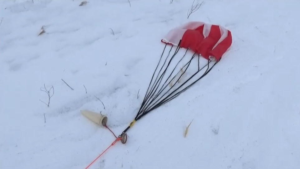
minute later the ‘pop’ of the main deployment charge was heard and the rocket
was spotted descending under a fully blossomed canopy, about 1000 feet
downwind. The rocket gently touched down in a snow-covered field. We then
noted the GPS coordinates on the BRB receiver and entered these into the
handheld GPS unit. Although we visually spotted and marked the touchdown
site, we wanted to test the recovery process using the GPS signal from the
rocket. The handheld GPS unit indicated distance to touchdown site, and
direction. We then tracked the downed rocket using this information and it
led us exactly to where the rocket was situated. The rocket looked to be in
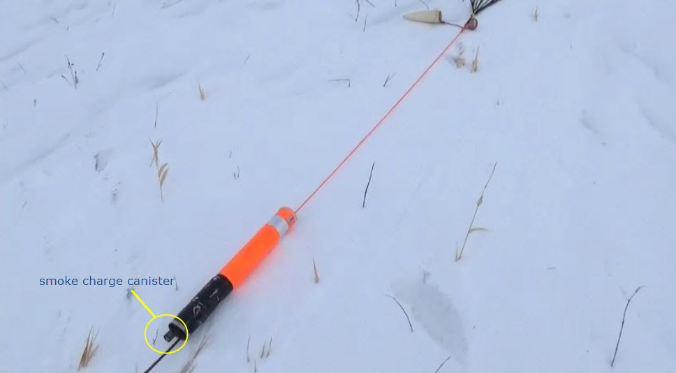
great shape, and examination of the smoke charge revealed that it had indeed
fired.
|
|
Flight
Analysis
|
|
Event:
|
Time (sec)
|
feet
|
metres
|
|
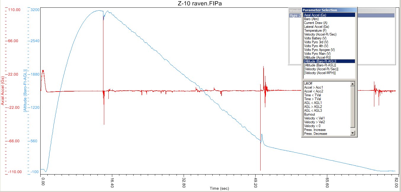
Apogee
|
13.2
|
3143
|
958
|
|
Separation
|
14.4
|
-
|
-
|
|
Main deployment
|
50.3
|
564
|
172
|
|
Touchdown
|
77.4
|
|
|
|
Range
|
|
690
|
210
|
|
Descent rates:
|
ft/sec.
|
m/sec.
|
|
|
Free-fall
|
71.7/75.8
|
21.9/23.1
|
|
|
Main parachute
|
19.1
|
5.8
|
|
|
Post-flight
analysis and comments:
|
|
Good Raven data and on-board video footage was obtained.
The rocket had a significant roll (spin) during ascent which reduced the
value of the video footage. The same was true during descent. The BRB GPS
beacon functioned nominally and was fully effective in locating the rocket
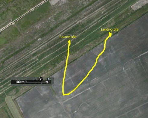
touchdown site. A plot of the BRB GPS data file using Google Maps indicated
that the rocket veered quite significantly into the wind (approximately), by
about 230 metres at apogee. This was an interesting
and useful revelation.
The smoke charge fired and must have left a smoke trail,
however, nothing of the sort was sighted during descent. This was undoubtedly
due to the grey sky and lack of sun (the smoke is greyish colour).
The smoke charge will be flown again on the next flight, but will only be
activated if the sky is clear and sunny. Clearly, as this flight demonstrated, the smoke charge
is of no value on a non-sunny day.
|
Raven baro and accelerometer graph: Z-10\Z-10_raven.jpg
Photos:
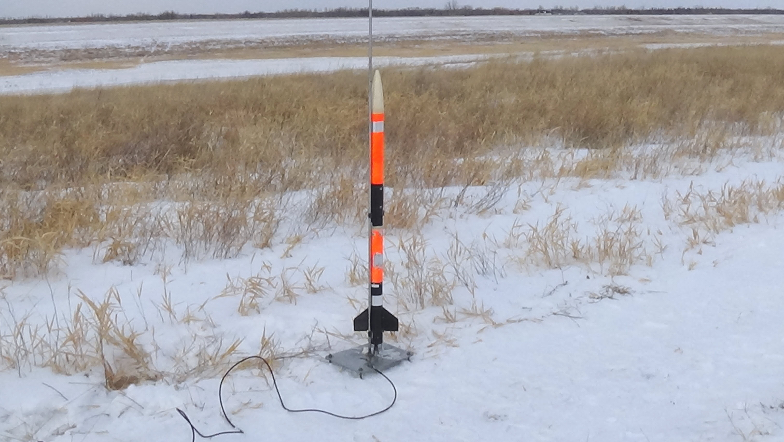
Zeta-10 on launch pad Z-10\DSC00041.JPG
Touchdown site Z-10\DSC00046.JPG
Wind inflating the chute on
ground Z-10\DSC00047.JPG
Rocket safely on ground Z-10\Dsc00048.jpg
Z-10\capture_landing6.jpg
Z-10\capture_landing5.jpg
Z-10\capture_landing4.jpg
Z-10\capture_landing3.jpg
Z-10\capture_landing2.jpg
Plot of flight path based on GPS
data Z-10\BRB_GPS_plot.jpg
Fabricating new nosecone to house
BRB Z-10\DSCF3460a.JPG
New nosecone Z-10\DSCF3466a.JPG
Z-10\DSCF3467a.JPG
Nosecone and BRB GPS unit Z-10\DSCF3468a.JPG
Videos:
On-board video Z-10\Z-10_onboard.mp4
Final descent Z-10\Z-10_descent.mp4
